Warning about “Identification of 44 high-risk areas for land subsidence” in Iran
The head of the Mapping Organization says dozens of regions in Iran are affected by land subsidence, and the situation is more acute in Tehran and Isfahan provinces. Masoud Shafiei also reported that the Caspian Sea is receding at an average rate of 10 centimeters per year.
About two years ago, the country's Mapping Organization was entrusted with studying and investigating the extent of land subsidence in Iran, about which worrying reports have been published about its dimensions.
Masoud Shafiei, head of this organization, told ISNA news agency on Monday, July 2nd, that during this period, 44 high-risk areas in terms of land subsidence have been identified in Iran by reviewing measurements and data from the last 15 years.
He says that after identifying the subsidence areas, geologists assess the level of risk and probability of sinkholes in different areas based on data collected by this organization.
According to Shafiei, identifying high-risk areas is done using four methods: "precise alignment," "use of permanent geodynamic stations," "gravimetry," and "interferometry of satellite radar data," and the Geodynamic Network stations of the Surveying Organization report and record changes in the earth's crust every 10 to 30 seconds.
Tehran and Isfahan provinces are the most severe areas.
The head of the Mapping Organization told ISNA that Tehran and Isfahan provinces are among the most severe areas in the country in terms of land subsidence, and according to assessments over the past 15 years, this rate reaches about 30 centimeters per year in areas such as the southwest of the capital.
Regarding the consequences of land subsidence, Shafiei said: "In some cases, unfortunately, this phenomenon has affected vital infrastructure, roads and airports. In addition, sinkholes that were created in the plains of Hamedan province could be affected by the subsidence phenomenon."
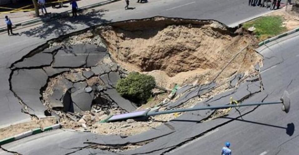
So far, the ground has subsided in many cities in Iran for various reasons, causing great damage. Many images and videos about such incidents have been published on social media.
"Voice of Isfahan" recently published a short video of a bus being pulled out of a three-meter-deep hole on Mirza Taher Street in the city, writing that dozens of such incidents have occurred in different cities of the province in the last month or two.
The head of the Mapping Organization mentioned provinces such as Khorasan Razavi and Qom as other high-risk areas in terms of land subsidence, but did not explain the cause of this phenomenon.
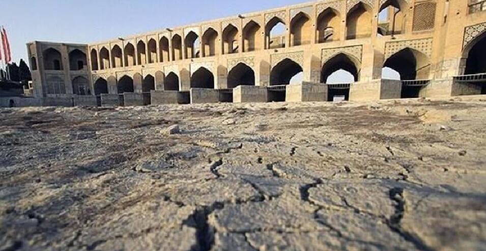
Some experts believe that excessive exploitation of groundwater and the complete or partial drying of Iran's most important ponds and lakes could be greatly effective in exacerbating the land subsidence crisis.
Caspian Sea water retreats 10 centimeters per year
In another part of his speech, Shafi'i referred to the Surveying Organization's efforts to monitor water fluctuations in the northern and southern seas of Iran, saying: "In order to examine the level of water fluctuations in the Caspian Sea and the Persian Gulf, tide gauge stations have been installed that measure and record changes in water height (water level) throughout the day and night."
The head of the Mapping Organization called the rate of receding water in the Caspian Sea "significant" and noted that the water level of this sea drops by an average of 10 centimeters every year.
On May 26, ILNA News Agency reported, quoting environmental expert Mohammad Darwish, that in parts of Fars Province, the rate of land subsidence is 140 times the rate that the European Union considers critical conditions.
In November last year, Yahya Jamour, Technical Deputy Director of the Surveying Organization, discussed the results of research and assessments on land subsidence in various regions of Iran in a press conference.
He noted at the meeting that the rate of land subsidence is not the same everywhere, and for example, this rate reaches 26 centimeters per year in the Varamin Plain, 18 in Tehran, and about six centimeters per year in the Gorgan Plain.
According to ISNA, the technical deputy of the Surveying Organization had warned that it would not be long before land subsidence would affect Tehran's Azadi Square. The head of the organization had also issued a similar warning a month earlier.
Source: DW